

 Please log in to see the coordinates.
 2x Found
  2x Not found
  2 notes
  0 watchers
  Rated as: n/a
 1 x recommended


 Cache attributes


 Description
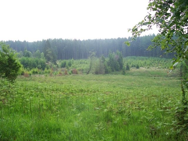
The forests in the Belgian Ardennes are a pleasure for a beautiful walk. The height differences are
not too high so it is quite relaxed for a longer distance to walk for and enjoy the scenery in these
areas have to offer. With a little luck (like i did making the route) can also spot some wildlife like
deer and other animals will roam that can be seen at certain times of the day.
Park your vehicle at the above coordinates and take some food and drink and then take a few points
to make with simple questions and enjoy the walk.
WP1 = A: N50 ° 12.286 E005 ° 46.443 Find a tree with a 3-digit number. Add these together and
count the results further up to one digit.
WP2 = B: N50 ° 12.418 E005 ° 45.605 Here's a house on stilts with a house number. Add these
digits together.
WP3 = C: N50 ° 12.472 E005 ° 44.876 Here is a monument with a text. Take the point value of the
fourth letter (A = 1, B = 2, C = 3 etc.).
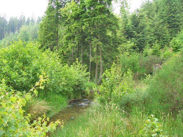
WP4 = D: N50 ° 12.259 E005 ° 44.409 What is here in the creek?
Tire = 9
Rock Block = 0
Bricks = 6
WP5 = E: N50 ° 12.024 E005 ° 45.850 Here's a?
Parking = 7
House = 3
Small lake = 8
Walk via N50° 11.757 E005° 45.936
WP6 = F: N50 ° 11.870 E005 ° 46.745 on the tree you see a 3 digit number and take the second
digit.
Now we have all the answers it is time to calculate the final location.
N50 ° E005 ° 12.DEA 45.F (C-1) (B-3)
For the CC code we use the digits of the answers found in order of find.
 Additional waypoints
| Stage | Symbol | Type | Coordinates | Description |
|---|---|---|---|---|

|
Parking area | --- | Parking | |
| 1 |

|
Physical point | --- | Hier vind je een boom met een getal van 3 cijfers. Tel deze bij elkaar op en tel de uitkomst nog eens bij elkaar op tot 1 cijfer. |
| 2 |
|
Physical point | --- | Hier zie je een huisje op palen met een huisnummer. Tel deze cijfers bij elkaar op. |
| 3 |
|
Physical point | --- | Hier vind je een monument met een tekst. Neem de letterwaarde van het 4e letter (A=1, B=2, C=3 enz. enz.). |
| 4 |
|
Physical point | --- | Wat ligt hier in het beekje? |
| 5 |
|
Physical point | --- | Hier zie je een? |
| 6 |

|
Virtual point | --- | via hier |
| 7 |
|
Physical point | --- | Op deze boom zie je ook een 3 cijferig getal en neem het 2e cijfer. |
 Additional hints
 Pictures

 Log entries:
2x
2x
2x
Log entries:
2x
2x
2x


